
DataSphereX
A cloud-based platform designed to seamlessly analyze geospatial and attribute data, integrating machine learning, statistical modeling, and interactive visualization to deliver powerful tools for geospatial intelligence and beyond.
Platform Features
Contents Management
- Supports multiple data formats, including Shapefile, GeoJSON, CSV, PDF, and Images.
- Import, Export, Duplicate, and Delete Data
- Organize and manage data using tags.
- Connect to ESRI Map Service and WMS Service
- Modify Data Properties, including data name, data description, data tags, column name, column data type, and column order.
- Show data field statistics, show data in the table and on maps.
- Enable collaborative data management by adding comments to datasets.
- Generate Shapefiles from CSV files containing latitude/longitude fields or H3 hexagon index IDs.
- Facilitate data sharing within teams at group or organization levels.
- Oversee and manage dashboards and data portfolios
Account Settings
- Manage group members
- Join organizations
- Deposit funds into the account
- View payment history
- Configure Google Maps API Key and Mapbox Access Token
- Monitor ongoing calculation requests and review completed requests from the past 24 hours
Products

Smart Redistricting
An award-winning redistricting software with powerful optimization algorithms and intuitive user controls. iRedistrict® excels in generating high-quality redistricting plans that meet both mandatory requirements and user preferences. Features include automatic district generation, manual editing capabilities, population equality maintenance, geographical contiguity preservation, and comprehensive reporting tools.
Learn More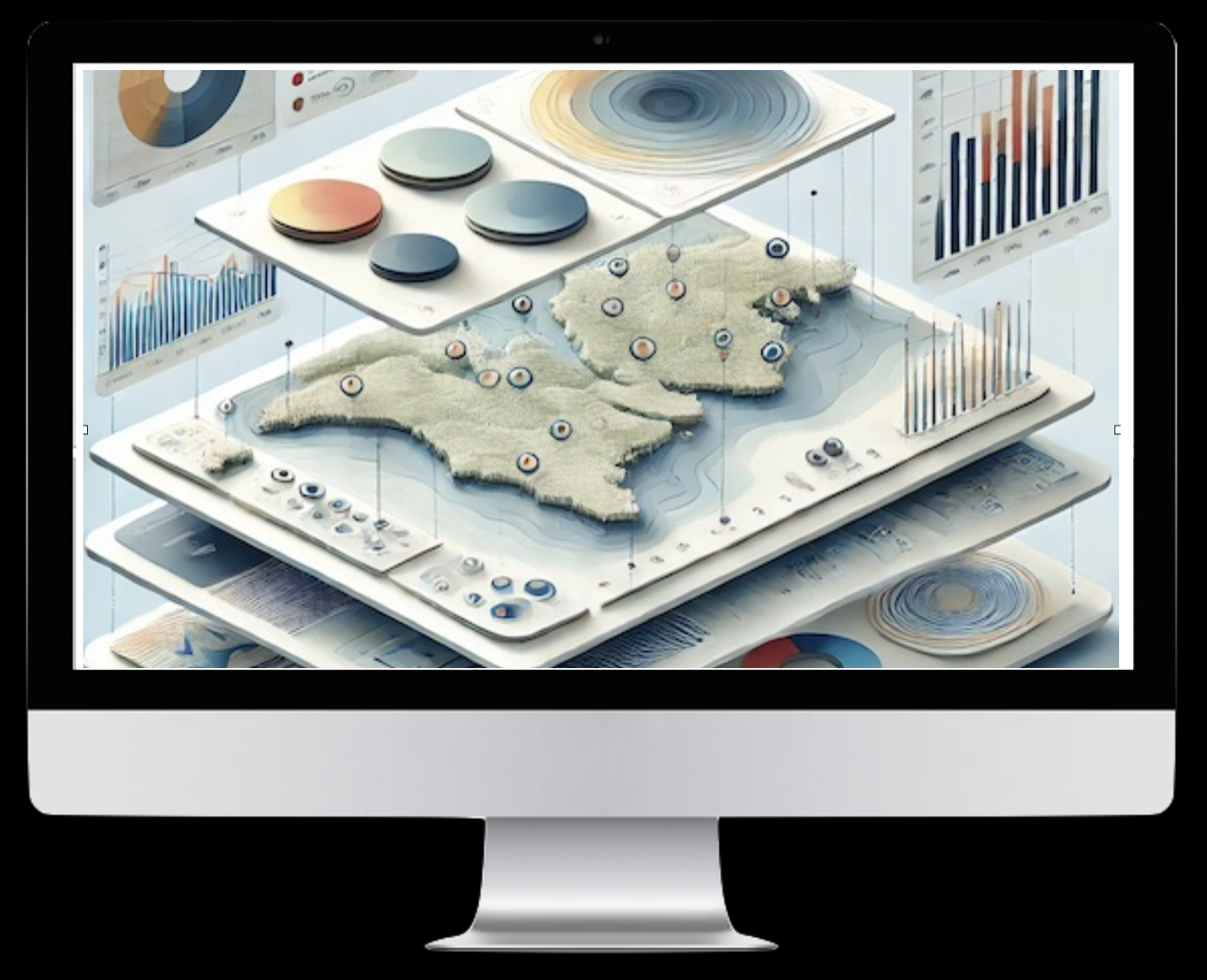
MapVIZ
Your all-in-one solution for interactive mapping and data visualization. MapVIZ enables you to layer maps, apply filters, perform group-by statistics, and generate dynamic charts. Visualize data through heatmap, bubble map, and classification by numeric and categorical values. Integrate seamlessly with basemaps, locate addresses effortlessly, and manage both spatial and attribute data.
Launch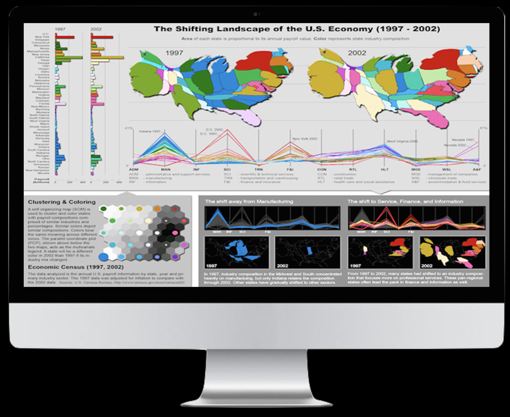
Multivariate Insights
Advanced tools for multivariate analysis, clustering, and spatial-temporal pattern discovery. Uncover patterns and relationships in your data through powerful statistical methods and interactive visualizations. Features SOMVIS for clustering, REDCAP for regionalization, and VIS-STAMP for exploring complex spatial-temporal patterns in multivariate data.
Learn More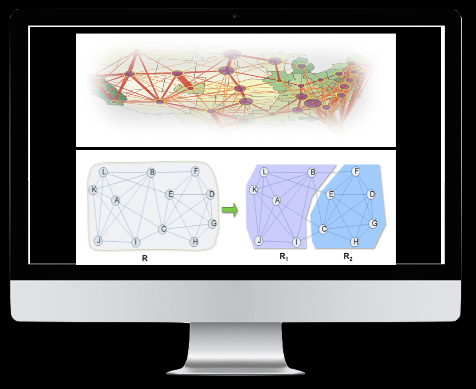
Flow and Graph Analytics
Comprehensive suite for analyzing spatial flows and network relationships. Includes tools for flow mapping, flow clustering, flow regionalization, and graph analytics. Perfect for understanding movement patterns and network structures.
Learn More
Toolbox
A comprehensive collection of geospatial analysis tools. Features include data processing, aggregation, spatial analysis, accessibility analysis, site allocation, and more. Essential utilities for any spatial analysis workflow.
Learn MoreConsulting Services
We offer comprehensive consulting services to help clients maximize the value of their data.
Redistricting Consulting
Assisting governments, organizations, and advocacy groups with fair and efficient district mapping using data-driven methodologies.
Data Processing, Analysis & AI Integration
Cleaning, transforming, and structuring large datasets to extract meaningful insights. Leveraging geospatial data mining to identify patterns and trends, supporting informed decision-making. Integrating machine learning and AI techniques to enhance predictive analytics and automate data-driven processes.
Whether you need customized solutions, strategic guidance, or hands-on data processing, our team is ready to help. Our expertise ensures that you not only have the right tools but also the right strategy to leverage your data effectively.